About Walton Manor
History
Historically agricultural land in the 1500s, Walton Manor evolved gradually into a varied residential area, supporting the growth of Oxford as a commercial hub and university town
Walton Manor takes its name from the farm acquired by St John’s College, with other land which now forms most of North Oxford, from the family of George Owen in 1573. He was Henry VIII’s physician and had acquired the lands of Godstow Priory and Rewley Abbey after the Dissolution of the Monasteries. The farmhouse is thought to have stood roughly where St Sepulchre’s Cemetery is now.
The area covered by the Walton Manor Residents Association includes the residential streets developed in “ad hoc” fashion between Observatory Street and Leckford Road in the first half of the 19th century which now form the Walton Manor Conservation Area, and the more planned development between Leckford Road and Farndon Road developed later in that century, extending west to include Southmoor Road. Woodstock Road forms the eastern boundary.
From 1573 onwards the area was largely used for agriculture although a 1769 map refers to part of it as a “shooting glebe” ie land allocated for the use of the Church- the Parish of St Giles at this time. The area north of St Giles’ Church was known as St Giles’ Fields or Walton Fields. Woodstock Road was clearly defined but Kingston Road was no more than a track. A route from Banbury Road and Woodstock Road along the line of what is now Bevington Road, St Bernard’s Road and Walton Well Road led to a ford across the River Thames to Port Meadow.
With the arrival of the Oxford University Press in Walton Street from 1713, the Radcliffe Observatory in 1773 and the Infirmary in 1779, the Oxford Canal in the 1790s (and consequent re-alignment of the Thames), and Lucy’s Ironworks by the Canal from 1824, the character of the area started to change.
Much of the Walton Manor area, according to their Enclosure Award map of 1832, was leased by St John’s to individuals for smallholdings, and sublet (often unofficially). The area south of St Bernard’s Road was mostly in the name of a Mr Tagg, and known as “Tagg’s Gardens”. The land north of Plantation Road was let to the Duke of Marlborough (ie the Blenheim Estate) and similarly sublet. The land in between was let to several different tenants. It is likely the whole area was used to produce vegetables and fruit, eggs and meat for the Colleges and for sale in the Market.
Whilst individual houses or pairs pre-dated 1830 (Vine Cottages in St Bernard’s Road are dated 1824) the first new street to be constructed, from 1834, was Observatory Street with its characteristic flat fronted terraces, now in varied colours. Adelaide Street, a dog-leg connecting Observatory Street to Walton Street, was probably constructed at the same time, although less of the original housing remains. St Bernard’s Road, then called Horse and Jockey Lane after the large inn with stables at the Woodstock Road end, was laid out a little later and renamed St John’s Road.
As Oxford became more of a commercial hub, and particularly with the arrival of the railways in the 1850s (and railway construction workers before that), the demand for housing increased and Oxford’s northward expansion accelerated. This part of Oxford was particularly suitable for building as it was above the flood level, unlike the south and west sides of the City, and the underlying stratum was gravel. Parts of Jericho had already been developed piecemeal and more streets were laid out around this time although flooding and drainage, particularly of sewerage, were a real problem.
St John’s started to realise the potential for increasing its income from agricultural to residential rents by encouraging building. Following a comprehensive survey of its North Oxford holdings in 1843, the College gradually established a system of letting land in plots, or groups of plots, to builder/developers who would build the houses to a budget set by St John’s, then sell on the leases to investors who then let to occupying tenants. Park Town, planned in the 1850s although not built and sold off til the 1860s, is the first example of this new system. It was not at first successful, perhaps because of the rather antique Regency style. A few houses along Woodstock Road built several years earlier share that style.
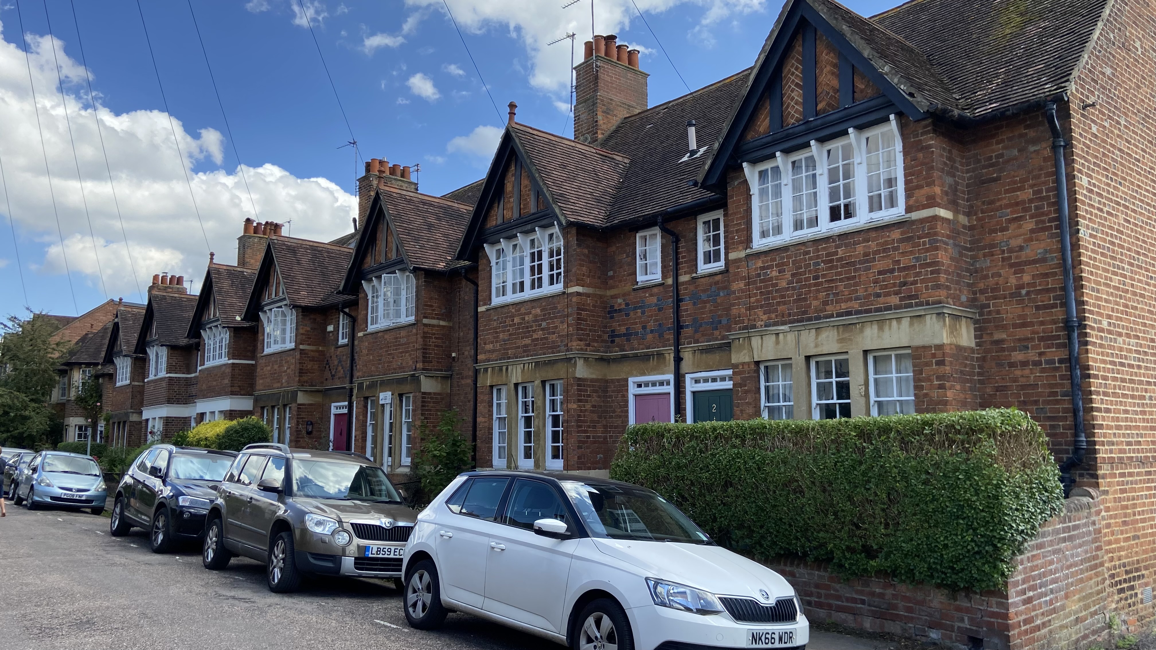
With the expiry of the Blenheim Estate lease in 1853, the area from Leckford Road northward was ripe for development. Over the next 30 years Kingston Road was established as another northward route, and Leckford Road, Warnborough Road, Tackley Place, Farndon Road and Southmoor Road (all named after parishes in the gift of St John’s) were built up in the classic Victorian brick style, a mixture of terraces for the working man and his family (including college servants) and villas for the “gentleman” and his family.
The streetscape of this part of Oxford was therefore settled in its current form by about 1850 for the area within the Walton Manor Conservation Area, and by about 1885 for the area further north. The position in 1850 is shown on an extract from Hoggar’s map, the first map to show the expanded Oxford in such detail.

The respectability of the area was enhanced with the construction of St Philip and St James Church- paid for by public subscription- on Woodstock Road and its associated school on Leckford Road in the 1870s. Leckford, Warnborough and Farndon Roads were laid out and adopted by the Council at St John’s expense in 1878. The pattern was well established by the date of the 1901 OS map.

The last 170 years have seen some significant new buildings, principally either student/post grad blocks or social or sheltered housing, and replacement and upgrading of much of the housing stock. Most involved demolition of early Victorian housing, on larger corner plots. The distinctive “feel” of the older part of Walton Manor, and the need for its protection, was recognised by its designation as a Conservation Area in 1975.
At the same time the roads to the north and west within Walton Manor Residents Association’s area were added to the North Oxford Victorian Suburb Conservation Area first established in 1968. The citation for the Walton Manor Conservation Area mentions its “intricate pattern of narrow streets” and its “human scale” with mostly small houses on small plots. Many of the earlier houses have variegated or “diaper” brickwork.
The demographic of the area has of course also changed over the last 170 years. Most of the houses are now owner-occupied. St John’s still owns a substantial amount of property although newer colleges such as Somerville, St Anne’s and the post graduate colleges of St Anthony’s and Green Templeton also have accommodation.
The butchers, bakers and boot makers (and beerhouses) who once traded from some of the houses, and shops along Kingston Road, have gone. The Gardeners Arms in Plantation Road and the Victoria in Walton Street are still important social centres and Walton Street buzzes with restaurants, a cinema, more pubs and some shops. As with other parts of North Oxford such as Jericho, Walton Manor has been “upwardly mobile” since the 1970s but jewellers and College chefs still happily co-exist with writers, lawyers and academics.
1850: Source - Oxfordshire History Centre
1900: Source - Ordnance Survey/National Library of Scotland
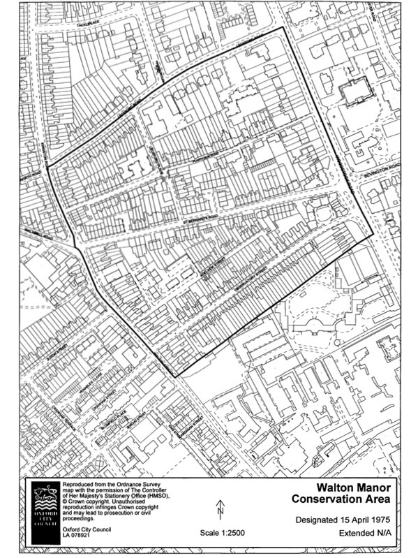
1975: Ordnance Survey

Pretty terraces on Kingston Road
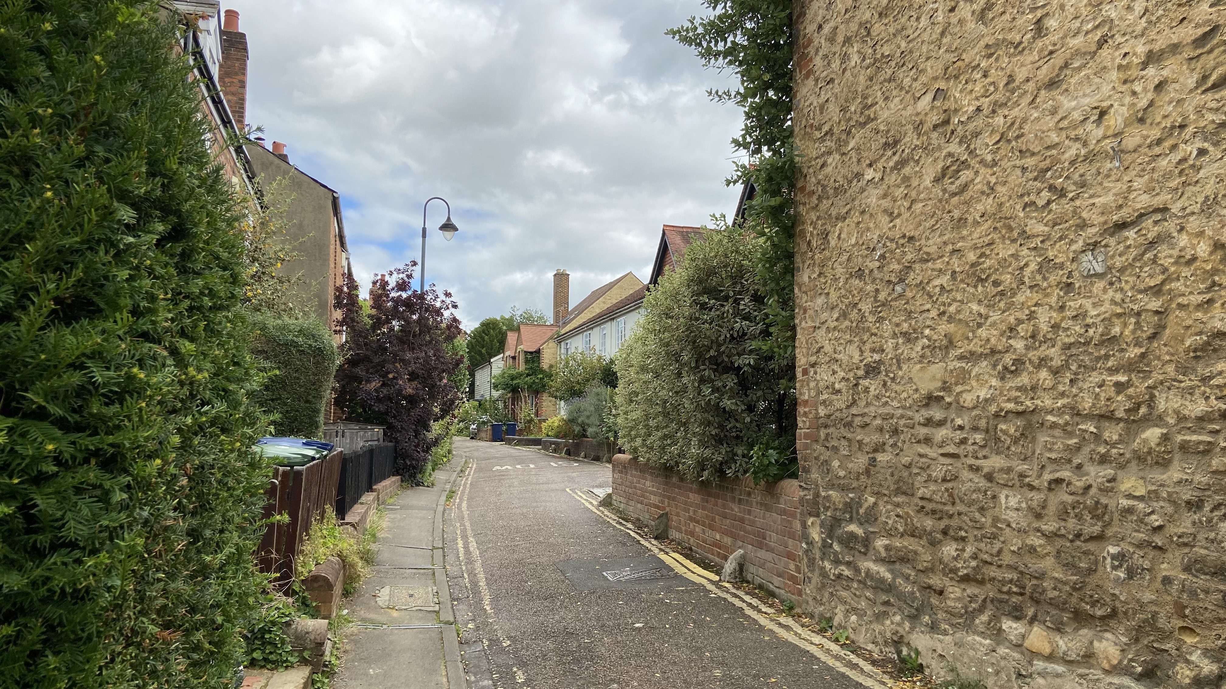
The 'country lane', Plantation Road
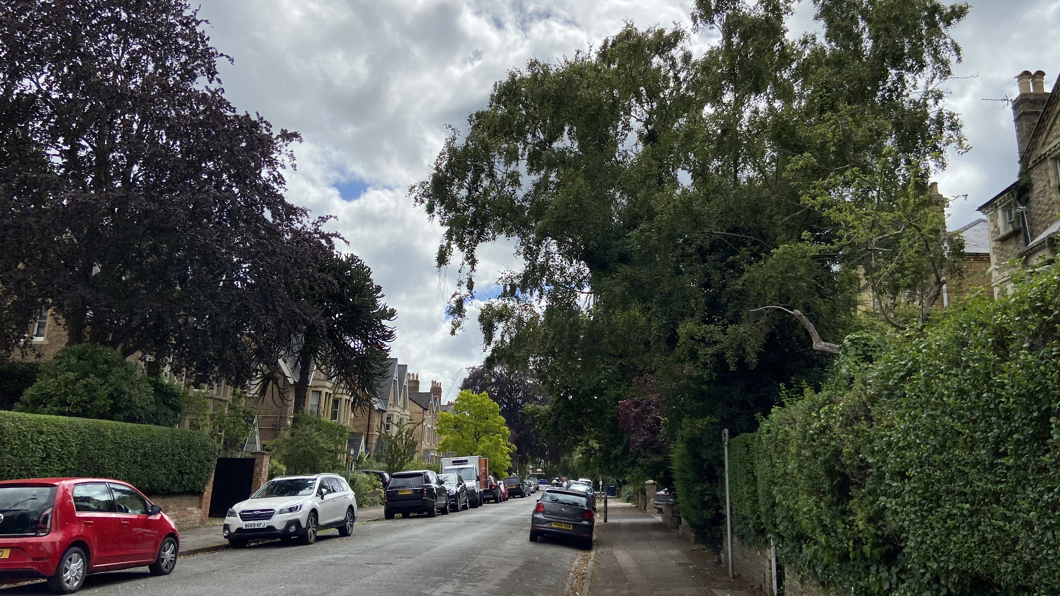
Tree lined Warnborough Road
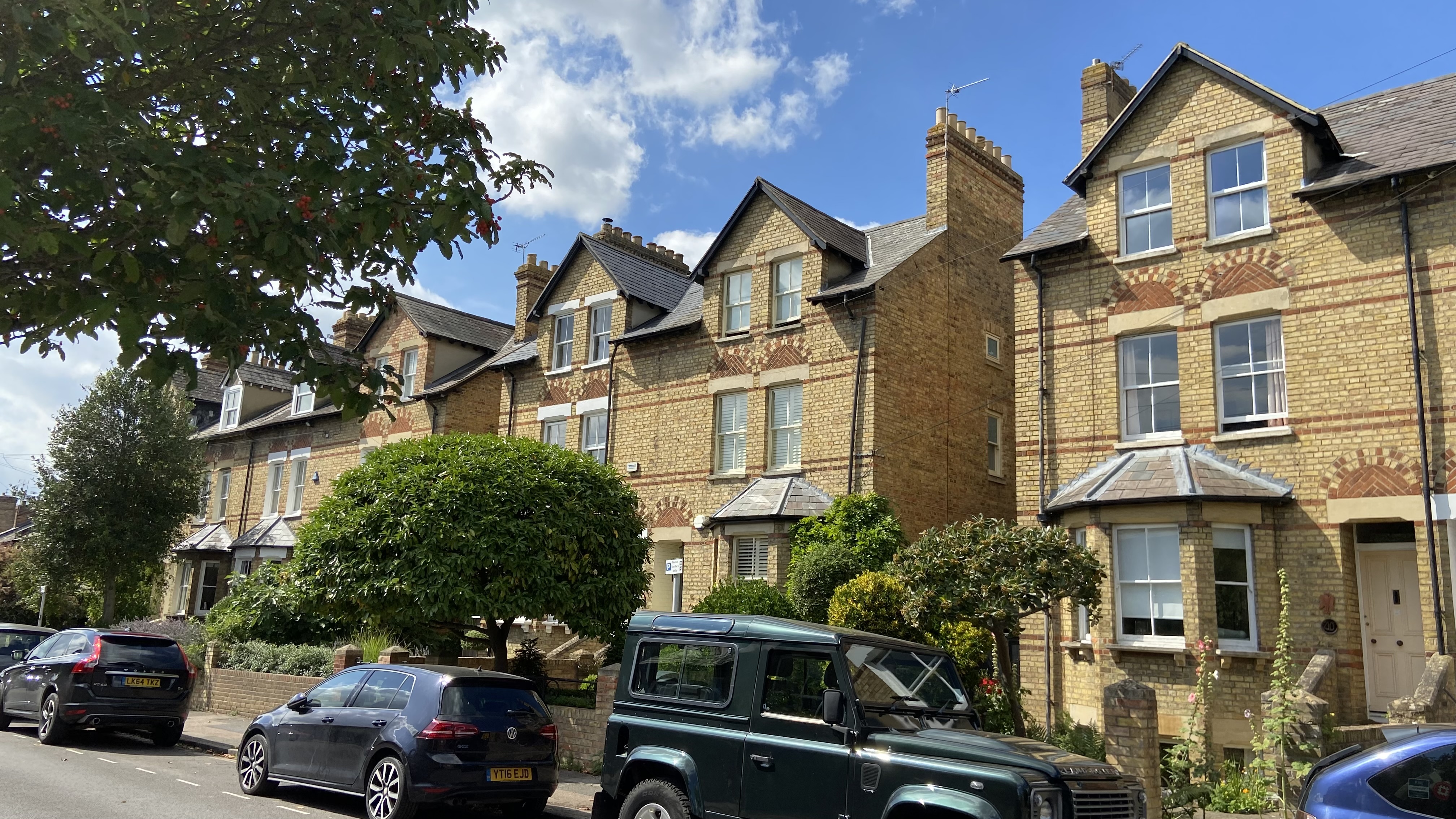
Villa Style homes on Leckford Road
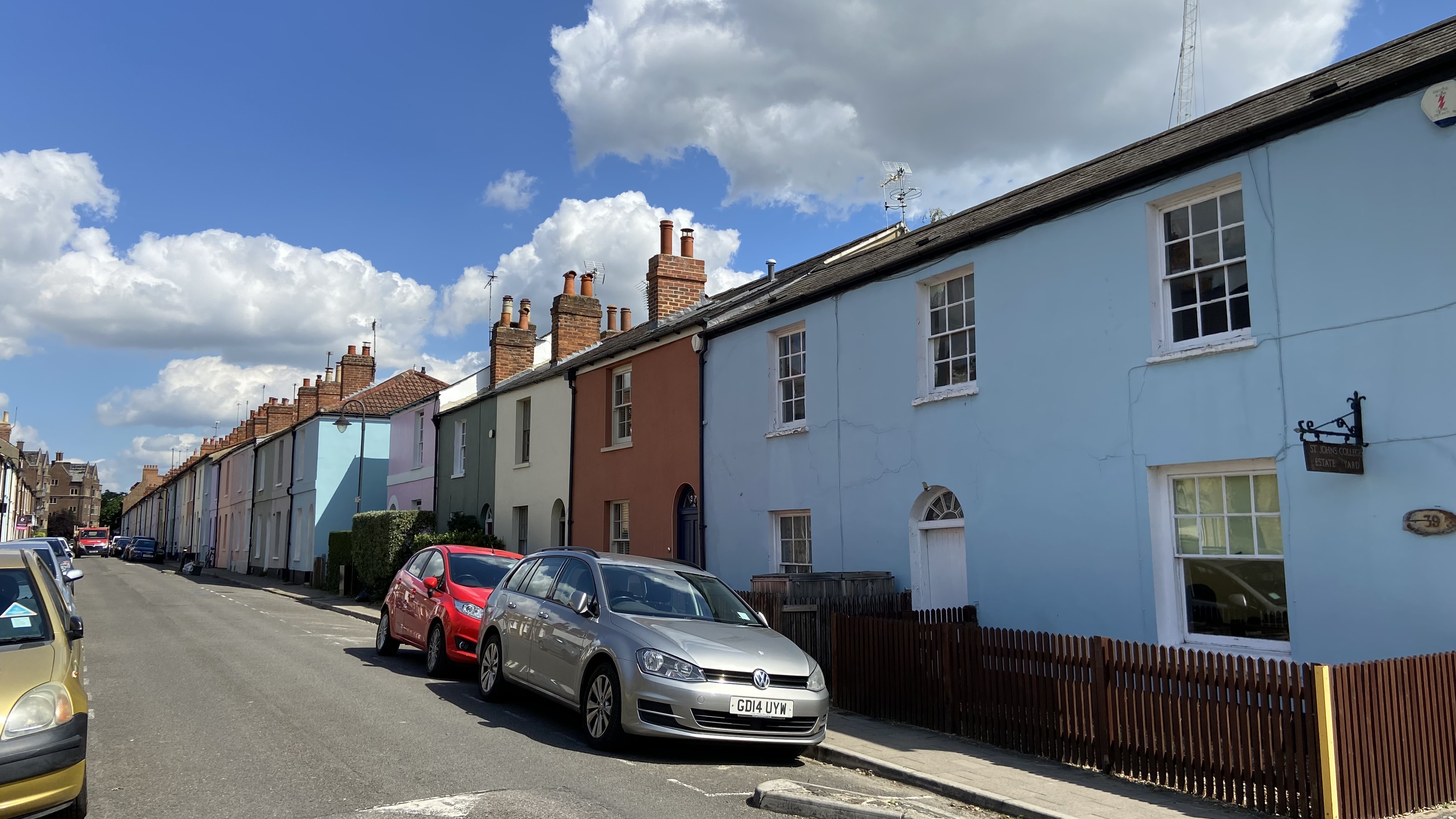
Coulourful frontages on Observatory Street
Country Style houses on Plantation Road